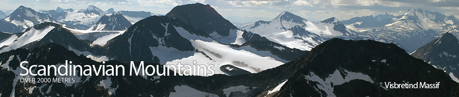
Scandinavian Mountains over 2000 metres - James Baxter
Areas › Visbretind Massif › 5.2 Semelholstind (2147m)
Semelholstind, 2147m, is the slightly smaller twin brother to neighbouring Visbretind and both share a similar topography. To the west and south of the mountain the Visbreen glacier wraps around it, while on the north side a steep face rises out of the glaciated corrie. It is not really feasible to climb Semelholstind alone due to its surrounding glaciers and the alpine character of its steep north ridge.
| The Route from Leirvassbu Lodge | |
|---|---|
      |
|
Leave Leirvassbu lodge and follow the path Ra.2 down the west side of Leirvatnet lake for a km and then up and over Høgvaglen pass for another km. From the pass drop down the bouldery south side and along the northern shores of the two Høgvagltjørnin lakes for 3 km to a path junction where the path Ra.8 forks to the south to Olavsbu cabin. Ignore this fork and continue west for 2 km along the north shore of Langvatnet lake until you reach an area covered in bouldery tundra and fed by many small brooks. Leave the marked path here and start to head north east up through a shallow bowl.
 The ascent up this bowl is pleasant as the south facing slope and many brooks make for an abundance of moss-fields and wild flowers. After an easy hour of ascent the lush fresh terrain starts to diminish as you encounter more and more moraine debris.
When the slope levels off at the start of the boulder fields at about 1750 metres start to veer east and pick your way across boulders weaving through easy outcrops and occasional snowfields up a huge shelf with an increasingly sharp drop down to Langvatnet lake to the south. After a further hours ascent you reach the minor top of 2005m.
From the top of 2005m now head north along the broad stony ridge past a gentle saddle enjoying great views in all directions before starting the pleasant ascent up to the peak of Sørvestre Urdadalstind, 2080m. Continue north along the ridge over this peak as it becomes increasingly sandwiched between the gentle south section of the Visbreen glacier and the steep crags down to the steeper glacier on the east side.
Just to the north of the peak is a steep gully on the east side which leads down to this 35 degree and often icy steeper glacier. About ½ hour after leaving the minor top 2005m you cross a very shallow rocky saddle are reach the minor top 2061m. It is preferable to descend the east ridge of this top to reach the large saddle below you to the east, especially if the aforementioned gully and glacier is not in good condition. The route to Semelholstind however is in the opposite direction across a narrow neck of glacier.
 This neck of glacier is regularly not given the respect it deserves. Although it is only a ½ km and just about flat it can be a dangerous place. To the north east is a massive ice cliff which has a cornice along the top of it. In poor visibility this is a death trap as one could all too easily wander off the edge.
Furthermore, despite common convention, there are some crevasses across this section, and these run in the same direction as travel. They may not be there every year but they are there under the firn type snow which covers this section of the glacier all year. It is thought that they might open up from the underside as this part of the glacier moves towards the ice cliff. People, however, cross it solo following old footprints and get away with it, but this is not recommended. So bearing this in mind rope up here and cross the narrow neck to reach the base of the south flank of Semelholstind.
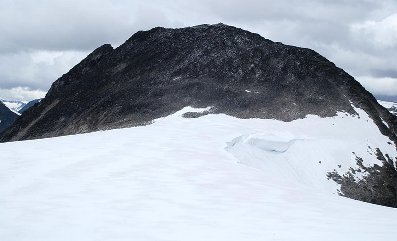 The south flank itself is a simple walk up boulders for ¼ hour to reach the summit itself. This ascent is not too steep, but it is probably best to keep slightly to the east side of the slope. Once on the quite airy summit ridge head west for a short distance to reach the cairn sitting on top on the vast vertical north face. It is worth heading east along the arête for 150 metres to look down the impressive north ridge.
The Return
The return is by the same route or down to the east from the top 2061 metres and into Semelholet as described in the alternative routes section.
If you want to use the Visbreen glacier route it is probably best to use this on the ascent instead and descend down the main preferred route to Langvatnet. On the descent there are large snowfields to the west of Sørvestre Urdadalstind on the edge of the glacier which can be used.