Scandinavian Mountains over 2000 metres - James Baxter
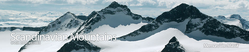
Areas › Memuru Veo Massif
 The Memuru-Veo is a large and diverse heavily glaciated region in central Jotunheimen. The massif is bounded by Gjende lake to the south, Visdalen and Urdadalen to the west, upper Veodalen to the north and Russvatnet to the east. There are 13 mountains in this area with another 17 secondary peaks and some 6 major glaciers in the massif.
Read more about Memuru Veo Massif ›
Mountains & Associated Peaks in Memuru Veo Massif
| Ref | Name | Height |
|---|---|---|
| 11.1 | Surtningssui | 2368m |
| 11.14 | Sortopp Surtningssui | 2302m |
| 11.22 | Søre Blåbrehøi | 2196m |
| 11.2 | Store Memurutind |
2366m |
| 11.15 | Vestre Memurutind V1 | 2280m |
| 11.16 | Vestre Memurutind V3 | 2243m |
| 11.19 | Vestre Memurutind V4 | 2230m |
| 11.26 | Vestre Memurutind V6 | 2140m |
| 11.3 | Store Heillstugutind |
2345m |
| 11.4 | Midtre Heillstugutind |
2339m |
| 11.21 | Nordre Heillstugutind | 2218m |
| 11.27 | Nordre Heillstugubrehesten | 2136m |
| 11.28 | Søre Heillstugubrehesten | 2120m |
| 11.30 | Heillstuguhøi | 2072m |
| 11.5 | Leirhøi | 2330m |
| 11.23 | Veobrehesten | 2185m |
| 11.6 | Austre Memurutind | 2301m |
| 11.7 | Søre Veotind | 2267m |
| 11.17 | Store Veotind | 2240m |
| 11.18 | Sørøstre Styggehøbretind | 2232m |
| 11.20 | Sørvestre Styggehøbretind | 2220m |
| 11.24 | Nordre Styggehøbretind | 2167m |
| 11.25 | Nordre Blåbrehøi | 2165m |
| 11.29 | Nordre Veotind | 2120m |
| 11.8 | Nestsøre Heillstugutind | 2255m |
| 11.9 | Semeltind | 2236m |
| 11.10 | Søre Heillstugutind | 2189m |
| 11.11 | Veobretind | 2189m |
| 11.12 | Hinnotefjell | 2114m |
| 11.13 | Spiterhøi | 2033m |
Detailed information about Memuru Veo Massif ›
Walking routes in Memuru Veo Massif ›
Accommodation in Memuru Veo Massif ›
Access to Memuru Veo Massif ›
Memuru Veo Massif image gallery ›