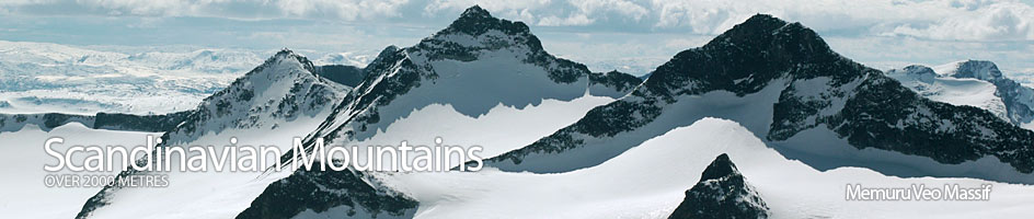
Scandinavian Mountains over 2000 metres - James Baxter
Areas › Memuru Veo Massif › 11.11 Veobretind (2189m)
Veobretind, 2183m, is a wedge shaped nunatak in the large and crevassed Veobreen. It has a gentle south-west ridge which descends into the ice and reappears again just 40 metres to the south west as the steep north east ridge of a unnamed top marked as 2264m. The ridge almost splits this upper section of the glacier in two and if the retreat of Scandinavian glaciers continues it wont be long before it emerges form beneath the ice. Apart from the gentle south west ridge the rest of the mountain is steep and rises dramatically from the glacier.
| The Route from Spiterstulen Lodge | |
|---|---|
      |
|
From Spiterstulen Lodge head south up Visdalen valley, keeping about 200 metres to the east of the river on the substantial path. Follow this path for about an hour crossing a couple of smaller streams until you have covered the 3½ km to where the path divides. One branch continues south over 2 substantial log bridges while the other head up to the south east in the direction of the tumbling Heillstuguåi steam. Follow the latter path for half km until it is beside this glacial steam by a gorge.
The obvious path now follows this stream keep on the north side of it for a further three km. The first half across pleasant meadows and the second half across glacial debris, but much of this is gravel and the path remains good. About half km before the snout of the Heillstugubreen glacier the path peters out and it is time to begin the sustained climb up to the Veoskard saddle.
This climb has little to commend it. It is over 500m in ascent most of it across steep, relentless boulders which are reasonably stable. It is probably best to go a little to the east of the direct line and then turn north again for the steepest section. A plus point of the climb is the impressive unfolding view to the south over the towering Heillstugutind ridge with its various alpine peaks and nunataks. After climbing 400 metres the gradient eases, but the terrain is still a boulder field. After about 1½ hours climb the Veoskard saddle is eventually reached and more impressive views appear.
The Veobreen glacier extends right up to the Veoskard saddle on the north side and is easily accessed. A remarkable feature of the glacier visible from here is a huge ridge of moraine in the middle of the ice which extends the whole length of the glacier from just north of the saddle. It is not known whether this ridge of moraine sits on top of the ice as a river of boulders, or if it completely splits the glacier in two and extends down to the bedrock.
From Veoskard saddle descend initially for 200 metres on the north west flank to avoid some snow covered crevasses, before turning south east into a gentle hollow which may have a few rocks sitting on top of the ice. From here ascend up to the saddle formed by the south west ridge of Veobretind as it disappears under the ice. The ascent becomes a bit steeper towards the final approach. On this ascent a few larger crevasses will have to be crossed.
At the bottom of the ridge it is a short walk across large boulders for about 20 minutes to the summit. These boulders are initially rough red iron rich rocks but soon make way for the ubiquitous gabbro which is so prominent in the Jotunheimen. At no point is there any difficulty on the ridge which affords splendid views to the south and the huge north face of Store Memurutind.
The return is by the same route unless the descent route to Glitterheim lodge is followed. Alternatively it is also possible to return across the glacier to the Veoskard saddle. Here instead of facing the tedious descent down the scree to the snout of the Heillstugubreen glacier and returning to Spiterstulen lodge via Visdalen, it is also possible to ascend the 250 metres of boulders up to the mountain of Leirhøi and then continue north west to the mountain of Spiterhøi. From Spiterhøi it is easy to descend via Skauthøi and its north ridge to the Spiterstulen-Glitterheim marked path. This path can then be followed for an hour back to Spiterstulen (for more information see the pages on Leirhøi and Spiterhøi). If this alternative return is used add 2-3 hours, an extra 500m of ascent and 5 km distance.
