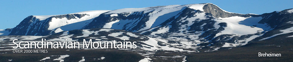
Scandinavian Mountains over 2000 metres - James Baxter
Areas › Breheimen › 15.2 Midtre Hestbrepigg (2160m)
Midtre Hestbrepigg is a huge rounded mountain scoured by glaciers on the north and south sides, lying in the middle of the Hestbrepigg massif.
| The Route from Netosætri | |
|---|---|
      |
|
At the very picturesque and traditional seter hamlet of Netosætri, park near the bridge that crosses over the Geitåi stream. Take the first road to the east of the stream and follow it up for 200m. When the road splits take the lower (left) road and continue for another 200m until a path to the west (left) crosses a small stream over a small bridge. Take this path for 300m until you arrive at another bridge over the Geitåi stream. Do not cross this second bridge but take a much smaller path which leads up the hill from this bridge.
Follow this smaller path for about an hour as it climbs quite steeply up on the north east side of the Geitåi stream. The 500 metres of ascent is quite sustained but the spectacular gorge and waterfall break up the plod. If the path is lost through the dwarf trees and shrub it should always be easy enough to locate on the top of the gorges side. Eventually the sustained ascent eases as one enters a high grassy bowl with some wonderful camping places and a great view to the Hestbrepiggen massif. Continue up beside the stream across the very pleasant meadow toward the knoll 1539 m and the bottom of the Høgsetbreen glacier. About one km before reaching them there is a stream coming down from the north west and Geitåbreen. Follow this stream for a km to a point just west of knoll 1539m.
Here the easy meadows must be left and a steeper moraine mass be climbed to gain the ridge on the south of the Høgsetbreen glacier. The steepest moraine can be avoided by keeping to the west a little before traversing east again. Once on the main ridge it is another sustained but straight forward climb for another hour until the lower of two grey crags are reached. Both can be climbed over but it may be preferable to avoid the lower crag by traversing round the south side of it. From the top of the second crag the ridge continues rising to the west over an arm of the glacier before it eventually spreads onto the plateau. To the north east is a small top, Høgset 2103m, overlooking a spectacular drop to the east.
From Høgset there is a very gentle climb over large stable stones to the peak of Østre Hestbrepiggen, 2132m, which sits on a spur jutting out into the huge smooth bowl of heimste Breen glacier below. Across on the west side of this bowl is Store Hestbrepiggen itself and a profile of the days crux, the arête leading out to it. From Østre Hestbrepiggen the undulating plateau of large stable stones continues to the east for two km past a saddle level with the glacier and on up to Midtre Hestbrepiggen, 2160m. This mountain is also the start of the arête leading north to Store Hestbrepiggen.
The return is by the same route. Alternatively it is possible to go back to the saddle between Østre Hestbrepiggen and Midtre Hestbrepiggen and then follow the very eastern edge of the steepish glacier in a south east direction back down to the valley and the Geitåvatnet tarns. An ice axe as always is imperative and as glaciers change and crevasses may appear where it was previously safe to go some glacial knowledge is also essential. From the Geitåvatnet tarns head east for three km to knoll 1539m again and then follow the Geitåi stream back down to Netosætri.