Scandinavian Mountains over 2000 metres - James Baxter
Areas › Dovrefjell
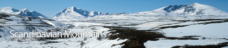
 Dovrefjell is a mountainous to the north of Jotunheimen and Rondane. It boasts six mountains and a further five secondary peaks over 2000 metres. The mountains are located in the east of a huge tract of land between Romsdalen and Sunndalen on the fjords and extending eastwards to Drivdalen, which lies inland of the main Scandinavia watershed on the high moorland tundra landscape. This area was made into a huge national park very recently called Dovrefjell-Sunndalsfjella.
Mountains & Associated Peaks in Dovrefjell
| Ref | Name | Height |
|---|---|---|
| 18.1 | Snøhetta | 2286m |
| 18.7 | Midttoppen | 2278m |
| 18.8 | Hettpiggen | 2261m |
| 18.9 | Vesttoppen | 2253m |
| 18.2 | Svånåtind |
2209m |
| 18.11 | Nordre Svånåtind | 2004m |
| 18.3 | Larstind |
2106m |
| 18.4 | Østre Langvasstind |
2085m |
| 18.10 | Vestre Langvasstind | 2046m |
| 18.5 | Skredahøin | 2004m |
| 18.6 | Bruri | 2001m |
Detailed information about Dovrefjell ›
Walking routes in Dovrefjell ›
Accommodation in Dovrefjell ›
Access to Dovrefjell ›
Dovrefjell image gallery ›