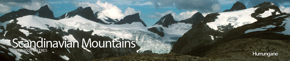
Scandinavian Mountains over 2000 metres - James Baxter
Areas › Hurrungane › Fannaråken › Alternative Routes
There are a number of ways up Fanaråken, the simplest way is from Turtagrø as it does not involve any glacier crossing and this is described below. The shortest way is from Sognefjellshytta lodge, but this involves a glacier crossing and the relevant experience and equipment. This short way is a fantastic route in the spring for a ski ascent. The third way is from Skogadalsbøen lodge and while this is ideally a summer route, it is also possible in the spring on skis.
Both the routes from Sognefjellshytta and from Skogadalsbøen lodges are described here. It is quite common to combine any two of these three routes to traverse the mountain in a day. There is also a unmarked route traversing over from the mountain of Steindalsnosi to the north, via a scree and boulder covered saddle, which is also described here.
The Route From Sognefjellshytta Lodge
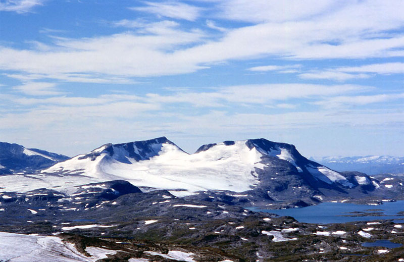
From Sognefjellshytta Lodge follow the route Hu.3 round the east and then south shore of Prestesteinvatnet lake for 4 km. Then leave the shore and head south for a km to the edge of the glacier. Rope up here and then head south up the initially steep glacier. As the glacier levels off, a snow/ice ridge comes into view curving up to crags below Fanaråknosi, 1990m, at the east end of the summit ridge.
Head for the base of this snow/ice ridge and then ascend the glacier to the east of it, to avoid the steep slopes up to Fanaråknosi. Keep ascending the glacier to approach the south ridge of Fanaråknosi itself. The further to south you go as you approach the ridge the less the final gradient onto the ridge itself is.
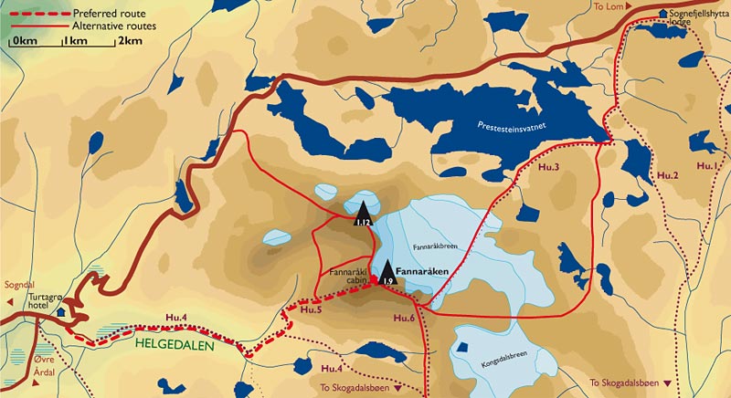 Once on the ridge you meet the marked path from Skogadalsbøen lodge to Fanaråken, Hu.6, which is then followed for 2 km to the summit as described in the next paragraph. This route is a classic in the spring on skis when much of the problems posed by crevasses are still covered, after late May however you will have to be wary of crevasses. The large cornices along the north side of the summit ridge are in constant danger of falling throughout spring and this area of the glacier below them should also be avoided as it is avalanche prone at this time.
There is guiding from the cabin down the glacier leaving at 1100hrs and from the bottom edge of the glacier back up at 1300hrs, during the time Fanaråken cabin is open in the summer (July and August). It is possible to go from Sognefjellshytta to Fanaråken without going onto the glacier. To do this follow the route to the east of Prestesteinvatnet lake for 2 km then continue south for another 3 km past numerous small tarns, over a small saddle and into Steindalen. Do not descend into Steindalen but head south west and then follow the shore of Øvre Steindalsvatnet lake.
From the south shore of this lake head south west for a km to the knoll 1605m. At the knoll veer west across the snowfields, which are the remnants of the glacier marked on the map but since melted, and then continue west for another 1½ km to reach the south ridge which is easily gained to meet route Hu.6. which is followed for 2 km to the summit as again described in the next paragraph. Both of these alternatives from Sognefjellshytta take about 5 hours The return can be by any of the other two ascent routes or via the saddle to the north with Steindalsnosi.
The Route From Skogadalsbøen Lodge
The route from Skogadalsbøen to Fanaråken is marked in the summer with cairns, and it also under the 'walking routes' section as Hu.6. From Skogadalsbøen head up to the Kaiser pass on the marked path which goes up Utledalen for 2 km and then crosses over the permanent bridge. Once over the bridge follow the pleasant Gjertvassdalen valley up for 4 km until you get to the private Gjertvassbu cabin and Gjertvatnet lake.
Do not take the smaller path to the west, Hu.7, but continue north on the marked path for a km up the west side of the lake and then up to the Keisarpasset saddle. Here at the saddle the path forks again. Do not take the path heading down the valley to the west and Turtagrø but continue north skirting about 300 meters to the east above a small tarn.
 Once you have passed the tarn the marked path starts to traverse steeply up stony ground towards what looks like a saddle at the bottom of the south ridge of Fanaråknosi. Just before this perceived saddle there some small snowfields and a small stream to cross. After crossing the stream a flat wasteland of stone and snowfield unfolds to the west rather than a drop. From here it is a sustained climb up the south ridge for about an hour to reach the top of the ridge, but as a consolation a magnificent view starts to unfold over the Smørstabb massif to the north east.
As you approach the top of the ridge the glacier route from Sognefjellshytta joins from the east. The route does not actually go up to Fanaråknosi but shirts round the south side of it and reaches the summit ridge just to the west of it, where another magnificent view unfolds over the glacier far below. From this little saddle it is a km walk westwards across what feels like the top of the world to the summit and the Fanaråken cabin. During this final km be vary of the cornices overhanging the huge drops to the north, and be exceptionally cautions in poor weather. This ascent takes about 4-5 hours. The return can be by any of the other two ascent routes or via the saddle to the north with Steindalsnosi.
Combined Ascent
A final but more demanding ascent route can combine the ascent of Steindalsnosi with Fanaråken. There are two alternatives both unmarked and seldom used and are only advised for the more experienced. The direct alternative is down the steep south ridge of Steindalsnosi and then up the north ridge of Fanaråken which gets very steep at the top for a short scrambling section. During the spring there is a cornice at the top of this scrambling section on Fanaråken and the route is not recommended.
An easier alternative to this direct route is via the saddle between the summit and west top (1936m) of Steindalsnosi. From this saddle drop down the steep unpleasant stony slopes into Steindalen, cross the valley floor and then traverse south up the flank of the south west ridge of Fanaråken for a good ½ hour until you intersect the marked path from Turtagrø to Fanaråken, Hu.5. Follow this path for an hour to the summit and cabins.