Scandinavian Mountains over 2000 metres - James Baxter
Areas › Galdhøpiggen Massif › Storgrovhøi › Alternative Routes
There are two main ways up Storgrovhøi both of which involve long days with around 1500 metres of ascent. Perhaps the easiest is the slightly longer route from Elveseter lodge because there is an rough tractor track which is followed for five km gaining 600 vertical metres rather easily. As a consequence it the route I describe as the preferred option. However it is not really the best route for a ski ascent in the spring as there is a slight avalanche danger on one section. For a spring ski ascent the alternative route, mentioned in the next paragraph, is very suitable.
 Park considerately at Ytterdalssæter, which is a short km up the road to Leirvassbu lodge from the Riksveg 55. From the seter head diagonally up the hill in a easterly direction heading for the saddle south of the knoll Kleivberget, 1174m.
From this saddle head south east up the for ½ km until you get to the heimre Illåi stream. It is best to try and cross this steam here above the gorge, as there is often a massive cornice overhanging the north west edge of the Dumhøi plateau above in the spring and early summer, which is it best to stay clear of. If the stream is difficult to cross continue up the west side of it across steep moraine until you reach the glacier where the stream is braided and slower across flatter land.
Once at the glacier clamber across the moraine to the north of its snout and then continue east starting to climb the loose moraine to gain a almost level area. From here the saddle between the Storgrovhøi and Nordre Storgrovhøi is visible to the south east. Leading up to this saddle is a gentle valley which holds the snow well. To the west of this valley is a ridge of stable stones which leads almost from the moraine pile marked as 1789m, to the summit and is easily followed.
To go to Nordre Storgrovhøi descend to the saddle to the north for ½ km and then continue north for another easy ½ km climb on stable stones. To return to Ytterdalssæter head west from this top down into the wide valley and descend down the snowfields to the east of the ridge you ascended to reach the flatter land north of the moraine pile 1789m. Allow 8-9 hours return, less on skis in the spring when you should allow 7 hours.
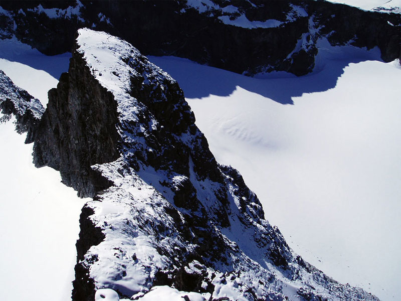
From the summit there is a prominent crest 300 metres to the south. This is Storgrovtind 2210m. It is a fine but sometimes loose scramble out to it with some exposed sections. If you want to make this excursion it is easiest to head 20-30 metres to the west of Storgrovhøi before descending to the south traversing under a steep crag to reach the arête. Just before and just after the saddle are exposed passage which are interesting scrambles. Return by the same route which should take a long ½ hour.