Scandinavian Mountains over 2000 metres - James Baxter
Areas › Hurrungane › 1.14 Østre Ringstind (2022m)
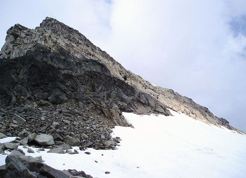
Østre Ringstind, 2002m, is also a pyramid that rises up from the glaciers at the end of Ringsdalen. The are 3 ridges on it, 2 of which descend into glaciers and the third descends steeply to a saddle and then a neighbouring top. It is a seldom visited peak being somewhat overlooked by its higher neighbours. None the less it is more challenging that many of these neighbours and an ascent up Østre Ringstind is a varied and exciting day in a relatively remote location.
| The Route from Turtagrø Hotel | |
|---|---|
      |
|
From Turtagrø drive the 3 km on the small road to Årdal, until there is a small rough gravel road heading south up Ringsdalen for ½ km. Park somewhere here and head down to the river, cross the dam, and then head up Ringsdalen and onto Ringsbreen glacier as described on route Hu.6 and also on the Store Ringstind page.
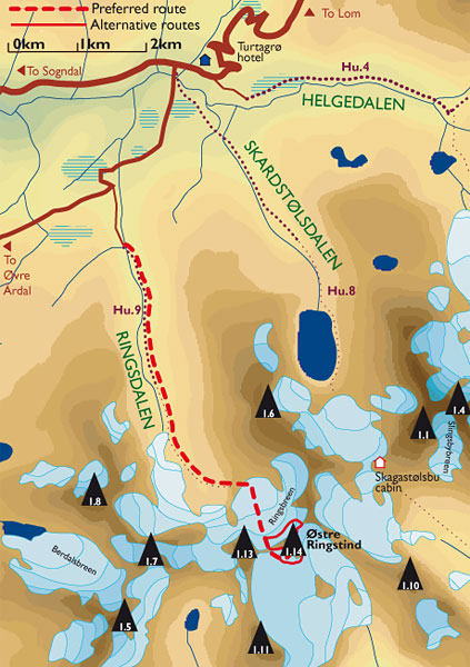 The route goes up Ringsdalen for 5 km and then steeply up the rock band on the east side of the valley headwall. Once at the top of this rock band head south for ½ km to the edge of the Ringsbreen glacier.
At the edge of the glacier, rope up and head south up to Ringsskard saddle. This is a relatively gentle glacial crossing of about a km. At the bottom there are some streams which have carved deep slots, and there might also be some small moulins (wells).
As you ascend keep to the obvious line up the middle of the glacier as this is relatively (but not entirely) crevasse free. At the saddle there is just a narrow band of flat easy slab to cross to get onto the Stølsmaradalsbreen saddle. The west ridge goes up from here.
From the saddle head east along the top of the glacier below the mountain for about 300m, until there is a ramp of snow heading diagonally up the mountain above a small isolated outcrop.
Follow this ramp up, still heading east for another 50m until the rock above becomes easier to ascend. Now head straight up the mountain to reach an isolated snowfield which persists until the mid summer at least. Climb some 100 vertical metres up this snowfield which is about 35 degrees until you reach the top of it. An ice axe could be essential here.
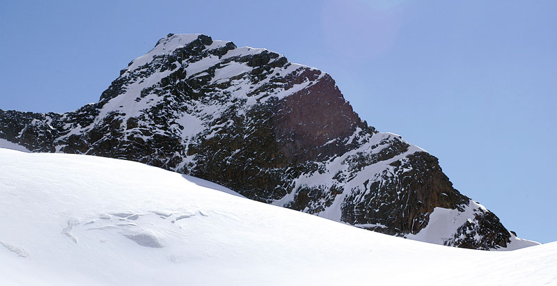 Do not stray too far to the east at the top of the snowfield as the rock over there is mostly slippery slab formations. Instead scramble straight up some corners for another 50 vertical metres until the gradient eases as you approach the top. Suddenly as you reach the top the awesome view eastwards over Skagastølstind and Styggedalstind bursts forth.
It is much easier in the spring to ski to the Ringsskard saddle than it is in the summertime to walk there. However the conditions on the south west face might thwart any attempt to climb it without additional equipment. Crampons and protection are recommended as some sections towards the top are steep and a slip could be fatal.
The return is by the same route to Ringsskard. It is a tall order to continue on an do the other two Ringstind mountains in a day but it is sometimes done.
 Unless you are proficient climbers willing to tackle the east ridge of Midtre Ringstind then it is necessary to skirt round the north side of Midtre Ringstind to Gravdalskard. This skirting round under the north side of Midtre Ringstind is steep, crevassed and also exposed to stones rolling down the ice. Ice axe, crampons, rope, rescue pulleys and experience are the minimum requirements here.
Once at Gravdalskard the route up Midtre and Store Ringstind are as described on those pages. To do either of the other two mountains add 2 ½ hours for each.
