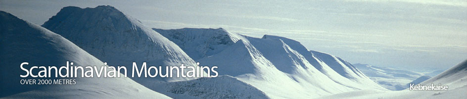
Scandinavian Mountains over 2000 metres - James Baxter
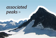
Areas › Kebnekaise › 20.1 Giebmegáisi (2104m)
Giebmegáisi, 2104 m, is the highest mountain in Sweden, and the highest in Scandinavia above the Arctic Circle. The mountain is composed of two tops, the south top and the north top connected by an exposed ridge, partly covered in ice. The south top is the highest only because its 2070 metres are covered in a pyramid of ice. This ice pyramid recently was nearly 50 meters thick, but has melted significantly in the last years and in 2003 was only 34 metres thick. In contrast the north top is bare rock and is 2097 metres high. So should the ice pyramid continue to melt much more then the north top will take over the status of the highest mountain.
| The Route from Kebnekaise Fjällstation (Lodge) | |
|---|---|
      |
|
This route described here is called the west way (västra leden) and is the usual way up Giebmegáisi. It is a long day as the route goes over a significant and unavoidable hill, called Vierranvárri, en route. But despite being long it is quite straightforward.
 Leave Kebnekaise lodge and head west under the steep outcrop of Kaipal, 773m for a km. Here the path divides with a branch heading down to Singi cabin, while the upper path continues westwards for another km until it also divides just before a stream. The west way continues across this stream, which can be a torrent, while the east way heads up the east bank. Cross the stream and continue west, towards the looming bulk of Duolbagorni, along an obvious track for another 2 km, when the track comes to another torrent, the Kittelbäcken stream. The track now follows the east bank of this stream, climbing quite steeply for a good km until it enters a large steep sided corrie and you get your first view of Giebmegáisi.
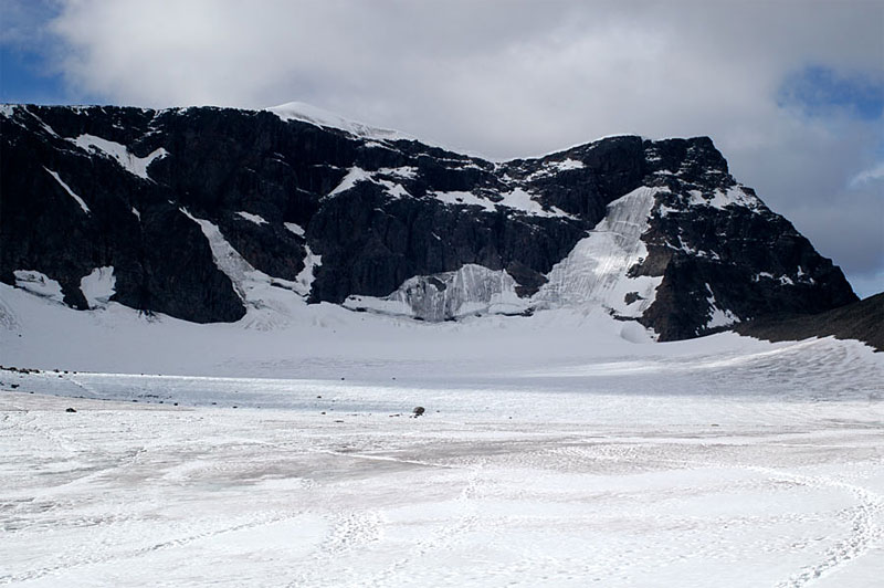
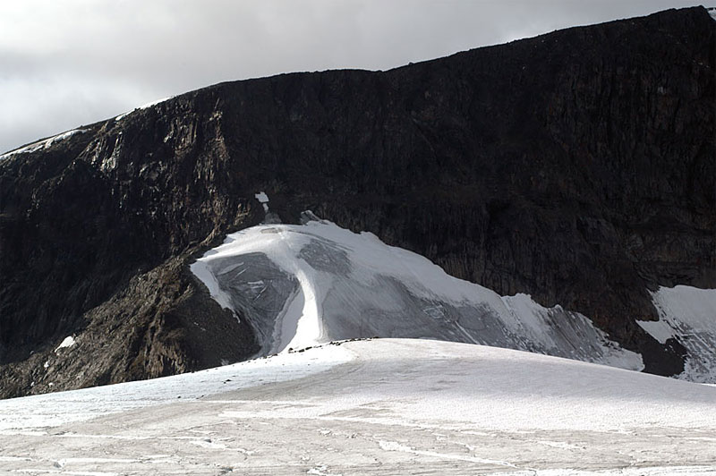
The path now crosses the stream. There used to be a bridge here but it was destroyed by floods, but may now be replaced. If it hasn't this can be a difficult crossing if there is allot of melt water and/or rain. There may be an easier wading point further upstream in the corrie where the streams' course is flatter and braided. Once over the stream, the marked path now traverses up across the lower north east slopes of Duolbagorni across stones, heading for a steeper section just to the south of a large snowfield extending down west from saddle between Duolbagorni and Vierranvárri. As you approach this steeper section and the snowfield the route, which is marked, becomes apparent and ascends up the easy bare rock on the south side of the snowfield for a short ½ hour to reach the stone filled aforementioned saddle between Duolbagorni and Vierranvárri.
From this saddle the marked path now ascends quite steeply up the stony south side of Vierranvárri for a good ½ hour. This tedious ascent eases towards the top where you are greeted by a vast array of stone cairns and the first view of the top of Giebmegáisi and the long south face up to it. Judging by the number of cairns here many people take a look at this anticipated slog up the south face and call it a day here and build a cairn.
 The path now, depressingly, descends quite steeply down stones, losing 200 metres in height into the high valley at the bottom of the south face of Giebmegáisi. However, the descent is quite quick. From this high stone filled valley there is another tedious stony ascent up the south face where the lost 200 meters of ascent are clawed back and another 100 added before the gradient eases significantly. The marked path now veers from north to north east and traverses across stones for a km gaining another 100 metres in height until the top cabin appears. On each side of the top cabin are a line posts with arrows pointing in the direction of it. There is another smaller triangular shelter 300 metres to the east of this cabin located 50 metres from the top of the cliffs above Björlings glacier.
The Swedes, like the Norwegians, have desecrated their highest mountain with a hut. However, the top cabin on Giebmegáisi was in 2004 an utter disgrace and should be an embarrassment to the STF, who run it. Dripping wet, stripped of everything except mouldy piles of rotting glass wool insulation and full of rubbish, it is hard to believe the STF allowed it to get into this state. It was an unsuccessful commercial enterprise, built with the excuse of safety, and then abandoned without any responsibility and a shrug of the shoulders. If the plans to remove it polish up the smaller triangular shelter 300 metres to the east are carried out the STF may be partially redeemed.
From the top cabin or shelter the marked path continues north across the gentle gradient for another km. During this km the gentle gradient almost levels off, but the terrain is still quite stony. There may also be some lingering snow patches here throughout the summer. As you approach the ice pyramid, the summit plateau narrows into a triangle with huge drops on each side in the direction you are heading, and you pass a sign indicating the direction to take. These drops on each side are often rimmed by large cornices so navigation has to be spot on as you approach the summit pyramid in poor visibility.
The summit pyramid itself is not to steep but maybe a bit icy or hard snow. Crampons however are not necessary as there will be already be steps up the south face of the pyramid, but an ice axe, as usual, should be carried. The pyramid is only 30-40 metres high and ends quite sharply. Beyond it to the north it narrows into an ice arête as it descends to the saddle to the north top. On either side are steep snow/ice slopes down to the top of cliffs which drop down to Björlings and Rabots glaciers respectively on each side. In this respect it is quite exposed. There can also be cornices at the summit so caution is required.
The descent is by the same route. If you have the glacial experience and equipment it is usually feasible to go down the east way (östra leden) as described above. Alternatively it is also possible to descend to Singi cabin as also described above, but this will be a long day especially with an over-night rucksack.
As a winter ascent the route from Singi cabin is preferable, with regards to time distance and skiing quality. The west way is steep from the Kittelbäcken stream onwards and only best skiers will enjoy it coming down it. Furthermore the south facing slopes do not hold the snow well and there may be some stones protruding Never the less it is very feasible. The slope from the corrie where the Kittelbäcken stream is up to the saddle between Duolbagorni and Vierranvárri may be steep towards the top and in certain conditions be avalanche prone. Information on this will be available at Kebnekaise lodge.