Scandinavian Mountains over 2000 metres - James Baxter
Areas › Kvitingskjølen Massif › 14.1 Østre Kvitingskjølen (2064m)
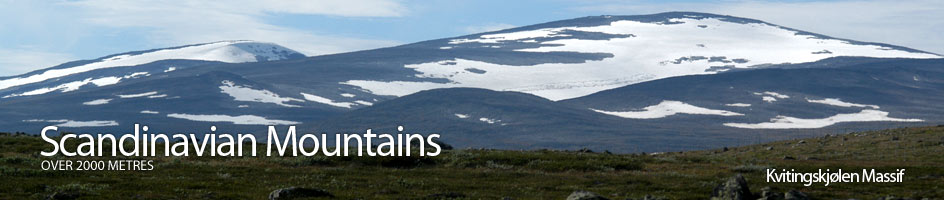
Kvitingskjølen, 2064 metres, is the highest point of a very rounded mountain which has two peaks separated by a shallow saddle. It is a relatively isolated massif divided from its neighbours by huge valleys; Ottadalen in the north and Smådalen in the south. An number of shallow scree covered ridges lead to its two peaks. These ridges are separated by streams that have carved deep ravines on the lower slopes. Due to the fact that Kvitingskjølen is so rounded, and by comparison not as dramatic as its spectacular neighbours to the south, it is relatively unvisited. It is quite possible to meet no one else on its slopes. The valley that divides its from the rest of Jotunheimen, Smådalen, is rich in wildlife including some elusive wolverine. The valleys that surround Kvitingskjølen are also rich with old seters, which are summer farms in the high pastures. Many of these seters are still in use and add a rich flavour of tradition and history to an ascent of Kvitingskjølen.
| The Route from Sålell | |
|---|---|
      |
|
Drive up the toll road to Soleggen Lodge. Approximately 250 metres before you get there take the turning to the left and continue driving for a further four km to reach the cabins at Sålell. Continue for a further half km to the end of the road near the bridge and park considerately. If making a ski ascent in the spring, park below Soleggen Lodge because the road to Sålell will be blocked by snowdrifts. It will be necessary to walk or ski to Sålell following the road which is marked by sticks along the snowdrifts. This walk or ski to Sålell from Soleggen will add nine km, 240 metres of ascent and 2 hours to the figures above.
From Sålell cross the river and start heading up the Kvitingi Stream for two km until it starts to narrow into a ravine. As the ravine deepens keep well to the south on the flat terrace where the going is easy. Follow this terrace above the ravine for two km until it flattens out again and then continue for a further three km in the flat valley. As the flat valley gently climbs it enters a large bowl between the two peaks of Kvitingskjølen. On the west is the lesser peak with its snowfield looming above the bowl. In the spring there is an enormous cornice on top of this snowfield; so be vary of it collapsing and keep to the east of the flat valley floor. While in the east a slope of scree leads to the main summit of Stor Kvitingskjølen.
The route now continues on the south side of the stream and up the slope of scree for 200 vertical metres over one km, until it reaches the shallow saddle between the two peaks. A spectacular view over Jotunheimen suddenly bursts into view as the saddle is reached. Especially spectacular is the imposing north face of Glittertind. From this saddle there is a very gentle climb heading almost due east across stable scree for another km until the summit and its huge cairn is reached. From here another huge open view unfolds including The Rondane mountains and the Dovrefjell mountains.
The return is by the same route. There is also an interesting alternative to retrace you steps to the saddle, then instead of descending down back into the bowl on the north side of the saddle, ascend the west peak, 2060 m. To follow this alternative from the saddle head south west over more scree towards the middle of a huge snowfield on the east side of the south ridge descending from the top of the west peak. This snowfield presents no problems in crossing. Once over the snowfield head north up the ridge for 100 vertical metres over a half km to reach the west peak. Again be wary of the vast cornice on the east side of this peak. From here descend down the north west ridge. In spring on skis it will be necessary to keep to the prevailing lee of this ridge as the south and apex of the ridge are usually sparse with snow, but not so far to the east you are over the cornice! Once past the knoll marked as 1818m it is best to leave the ridge and head down to the terrace on the south of the Kvitingi Stream ravine, especially if skiing in the spring as this terrace holds the snow well in comparison to the exposed ridge. The inclusion of this top also will only add a further one hour to the over all time.
There is an obvious spring ski route from Svartlii seter up Veselkjølen and then along the ridge from here to the main summit, but this ridge does not hold the snow well, and large areas are peppered with scree fields.
