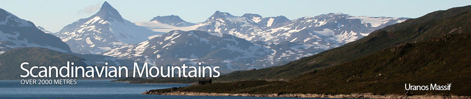
Scandinavian Mountains over 2000 metres - James Baxter
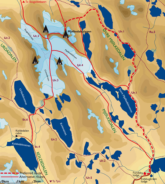
Areas › Uranos Massif › Mjølkedalspiggen › Alternative Routes
There are 4 routes up Mjølkedalspiggen:
- The long main route up the north flank from the Øvre Mjølkedalen valley, which is described below in the main section.
- The similar route up the north ridge from the Skogadalen valley.
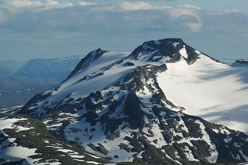
- The popular route up the Uranosbreen glacier to Sagi and then up the steep west ridge.
- The seldom used route up the south east ridge.
 The route from Skogadalen valley starts at Skogadalsbøen lodge goes east up the valley on path Ur.1 for 3 hours. You leave the forest and climb up out of a bowl into a flat higher valley peppered with a series of lakes.
Just beyond the stream which comes down from the glacier between Sagi and Mjølkedalspiggen is a flat grassy area before a steep prow. Start to head south here ascending between this stream and the prow until you gain a stony moraine ridge. Continue up the ridge to reach the glacier.
From here ascend up the ridge across moraine and slabs until the ridge becomes more defined and the gradient eases for ¼ km. At the south end of this flat section the ridge starts to climb again up across boulders for an easy ½ hour to reach the thin summit plateau.
The descent is by the same route or down the south east ridge to Fondsbu lodge unless you have glacial equipment. Allow 10-12 hours return to Skogadalsbøen lodge or on to Fondsbu lodge.
 The simplest route up Mjølkedalspiggen is seldom used. The route follows the path Ur.1 from Fondsbu lodge north towards Olavsbu cabin.
After 6km or 2 hours you reach a flat bay on the north shore of Mjølkedalsvatnet lake where a stream flows in from the north. Leave the path here, cross the grassy delta, jump the stream and continue round the flat north shore of Mjølkedalsvatnet lake skirting round the steep bulk of Storegut for 3 km into a moraine wasteland at the east end of the lake by the glaciers snout.
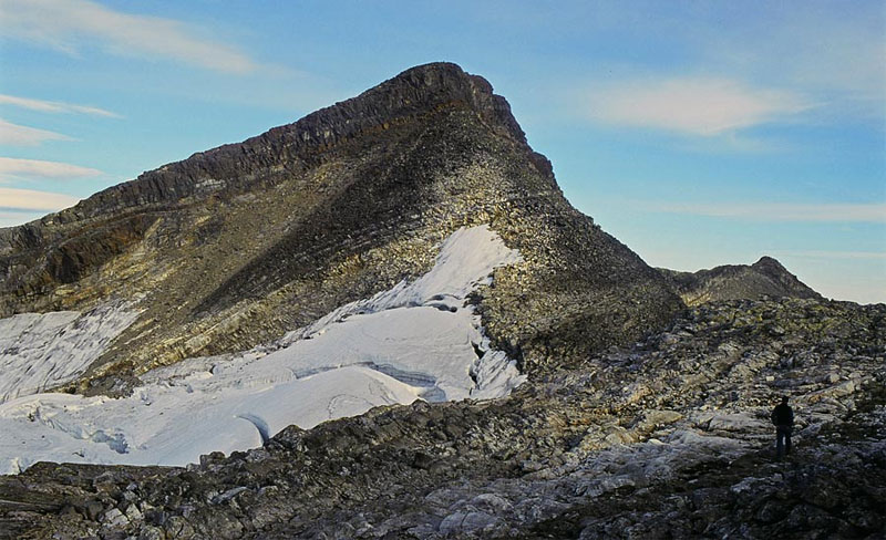
Weave through moraine and soggy silt round the north side of the glacier to reach the foot of the south east ridge. Start to head up slabs and snowfields at the foot of the broad ridge, which is not that steep. After an hour the ridge starts to narrow and boulders proliferate the route. In another ½ hour across more boulders you reach the knoll 1987m.
Continue north west along the stony ridge, following the edge of the glacier on the north, side for ¼ hour until you reach the base of a steep crag which leads up onto the summit ridge. The final 40 metre ascent up this crag involves some scrambling sections none of which are difficult. Once up there is a short and pleasant walk along the lofty ridge to the summit cairn.
The descent is by the same route or down the north ridge to Skogadalsbøen lodge unless you have glacial equipment. Allow 10-12 hours return to Fondsbu lodge or on to Skogadalsbøen lodge.
It is also possible to skip the ascent up the south east ridge and continue north along the west shore of the two Øvre Mjølkedalsvatnet lakes to reach the saddle at the foot of the north east ridge, which is then followed to the summit as described in the main section below.
 As Sagi is adjacent to Mjølkedalspiggen, separated by a simple saddle the two mountains are often combined. In which case the route is up the west ridge, culminating in a steep, and somewhat demanding, 10 metre scramble, which is a grade II climb.
From the foot of Sagi there is a long saddle heading east towards Mjølkedalspiggen. In the middle of this saddle is a rocky block of red-iron rich rock. You can either go south of this block traversing across slabs and boulders or round the north of this block which is easier but involves a short, and relatively simple, 10m scramble down the east end of the block above the top of the glacier. To the east of this block the west ridge of Mjølkedalspiggen rises.
Ascend this ridge for ½ hour up a broad ridge of boulders towards the top of the ridge where there is a steep 15 metre crag. This interesting crag involves a short 7-8 metre scramble up a shallow corner just to the north of the prow of the ridge.
This grade II very steep, but with good holds. During the winter/spring this is crag a serious undertaking and protection is essential, however it is possible to avoid it by skiing north across the glacier under the line of crags to a point on the north ridge until the crags diminish where the glacier meets the north ridge. From here it is simple to ascend the north ridge above the crags.
This traverse across the top of the glacier is heavily crevassed. In the winter the crevasses are still present but are partially full of snow and are covered. However, they still lurk under this snow cover to an extent.