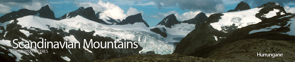
Scandinavian Mountains over 2000 metres - James Baxter
Areas › Hurrungane › 1.9 Fannaråken (2068m)
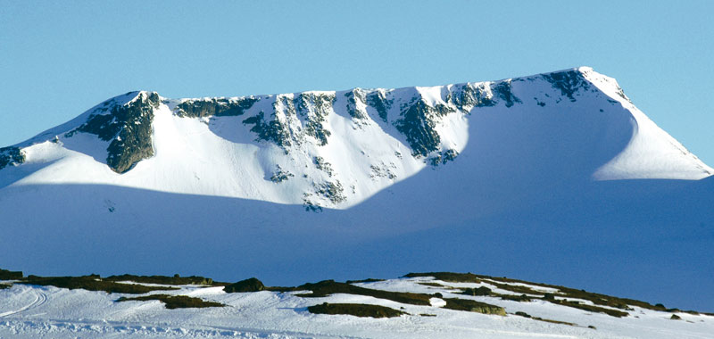
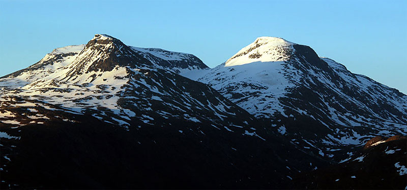
Fanaråken, 2068m, is a graceful sweep of a mountain when seen from the ancient Sognefjellsveien road. So commanding is its presence that it has inspired many authors and poets who have travelled the road through the centuries. Its gently rising summit ridge emerges steeply from the Fanaråkbreen glacier on the north side. On the south side scree covered slopes drop down to the crags above the alpine Illvatnet lake in the valley. On top of the mountain is a stunningly located cabin where there is an outstanding view across the valley to the Styggedals/Skagastøls ridge. This cabin, once part of a weather station, serves food and provides accommodation during July and August.
| The Route from Turtagrø Hotel | |
|---|---|
      |
|
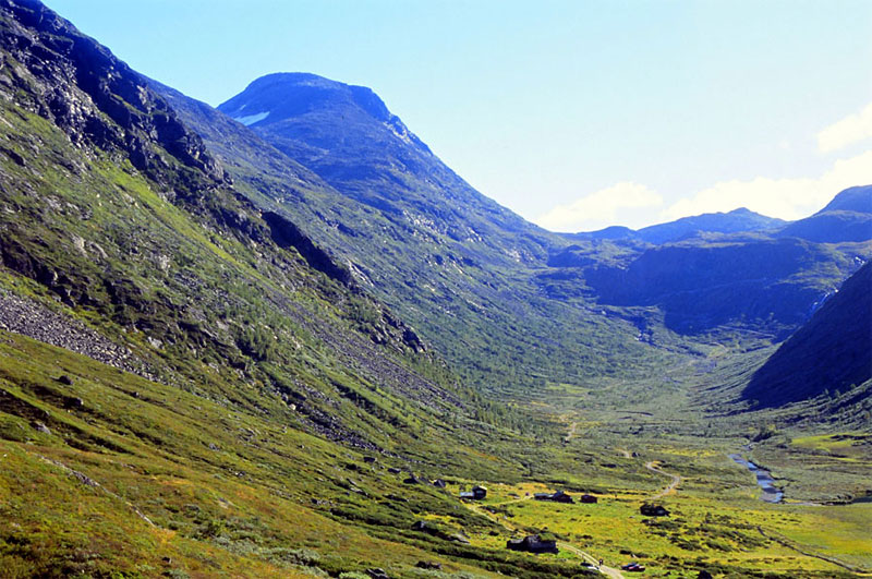
From Turtagrø follow the main road up for 400m until the first corner past the boom. Here on the lower side of the road a rough track gently descends westwards under the main road heading into Helgedalen valley.
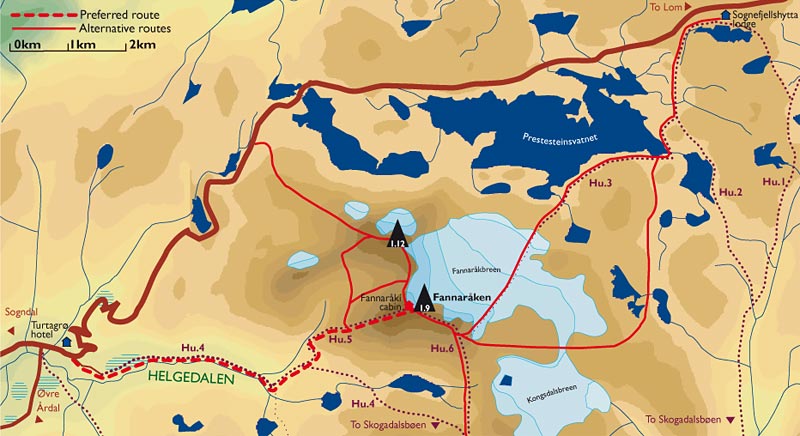 Leave this road and take this track for a good km passing to the south of some cabins. Just after the cabins you will meet a gravel tractor track. It is possible to drive to the locked boom by these cabins, but parking is very limited and it is unfair to clog up the area so the cabins owners can't park.
After reaching the gravel track head up the valley for an easy, flat 2 km until you come to a series of hairpin bends going up the steep rise at the end of the valley. At the fifth bend, and the last bend before the track crosses the tumbling Skauta stream, there is a sign posted path to Fanaråken and Skogadalsbøen.
Take this path which crosses a stream after 200m, and then after another 200m comes to the Ekrehytta cabin. At this cabin the path forks again with a marked branch heading west below the cabin heading for Skogadalsbøen lodge, while the path up Fanaråken goes to the west of the Ekrehytta cabin.
 From the cabin the route initially climbs up beside the tumbling stream emerging from the side valley of Steindalen for ¼ hour. It then veers away from the stream and starts to head up the steep base of the ridge. Although steep, the path is well established and zigzags up the worst bits so there should be no problems, even in the wet. After another ½ hour of sustained ascent up this steepest section the gradient eases out momentarily. From this flatter area the next section up the ridge unfolds.
This section also involves 400m of ascent but is not so steep as the previous section from the cabin. The good path on stable scree and is less arduous than it looks and after ¾ hour the steep crags by Marangs gjelet start to appear on the south side.
 The path continues to climb skirting round the top of these crags for another ¼ hour until the gradient eases at the top of a false summit.
From this false summit the well marked path gently climbs north west across the packed stones of the summit plateau for a final ¼ hour, to reach the cabins and just beyond the summit.
The westerly hut is the original DNT hut and the hut right on the summit is an old weather station which DNT has taken over.
Just to the east of the weather station hut is a flatter area above the cliffs and glacier where there is a marvellous view over the Fanaråkbreen glacier to the Smørstabb massif and the rest of Jotunheimen beyond. Fanaråken also gives a unsurpassed view to the huge north face of the connected Styggedals and Skagastøls ridges to the south.
 This route is feasible in the spring but is both steep to ascend and not a particularly enjoyable descent due to poor snow cover and steep terrain. If making a spring ascent on skis the alternative route described from Sognefjellshytta across the glacier such a classic it is the only option.
The Descent
The descent can either be by the same route or via any of the other 3 routes. If you want to be guided down the glacier to Sognefjellshytta during July and August you must be at the cabin before 1100hrs, which means either very early start from Turtagrø or overnighting at the very comfortable and stunningly located cabin.
It is also common to spend the night at the summit cabin and then descend to Skogadalsbøen lodge the next day, although this could also easily be done in a 8-9 hour day. A return via Steindalsnosi is only suitable for the more experienced.
