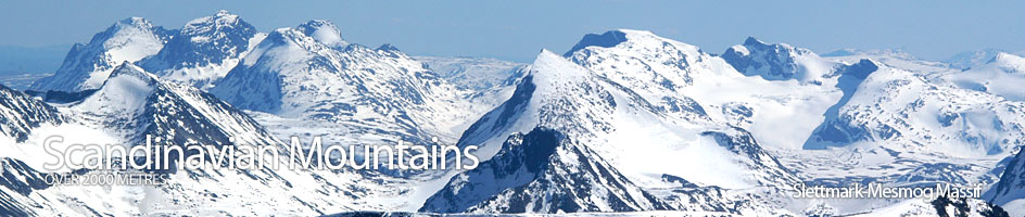
Scandinavian Mountains over 2000 metres - James Baxter
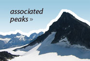
Areas › Slettmark Mesmog Massif › 6.5 Svartdalspiggen (2174m)
Svartdalspiggen, 2174m, and its associated peaks make up the northern end of the alpine ridge which lies between Svartdalen in the east and Langedalen in the west. This narrow northern end of ridge is still alpine in nature and offers some interesting climbing to grade IV, if the crest is followed.
| The Route from Gjendebu Lodge | |
|---|---|
      |
|
Leave Gjendebu lodge and take the path Sl.2 to Torfinnsbu lodge. This path initially follows Ra.3 to Fondsbu lodge and after 400 metres cross the bridge over the Storåe river. Then continue towards Fondsbu lodge for another 800 metres until the path divides and there is a signpost to Torfinnsbu on the southern fork, Sl.2, which soon crosses a bridge over the Veslåe river. Once over the river head east along the marked path through birch woods for almost a level km until the woods end. From here the path crosses scrub and some stony gullies climbing slightly for a ½ km until you reach the edge of a ravine.
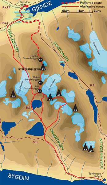 The path now zig-zags up the western edge of this ravine. The first 100 vertical metres of ascent are not too steep but the final 100 vertical metres are steep across and across bare rock where it is necessary to use hands. Eventually the gradient eases again as you enter Svartdalen, about 1½ hours after Gjendebu lodge. This section and part of the previous section is exposed to a significant avalanche risk in the winter and spring and therefore this route is not recommended during these seasons.
At this point leave the path and head west for ½ km along the lip of the flatter area overlooking the steep slopes down to Gjendebu lodge. Your route should be taking you towards a knoll on the north end of the north ridge. After the flatter ½ km the gradient steepens. Again keep to the north of the steeper face and continue towards the small knoll. The final 100 metres of ascent up to the knoll are steep and across mixed bare rock and scree. There are some vague markings along this stretch. Eventually at the top of this steeper section you gain a small plateau.
North Ridge
Follow this plateau go south across a pleasant mix of vegetation and slab for a km until it starts to steepen. There are great views along here over to the Nålene on Knutsholstind, across the valley to the east and down to the green Gjende lake. At the end of this flatter km the easier terrain ends in stones and the gradient steepens. Instead of going straight up the slope to the obvious pointed shoulder above, it might be better traverse up. Start this optional traverse by heading south traversing up across the slope for 300 metres until you are in the middle of the flank, then cut back up east for another 300 metres to gain a small flat area on top of the sharp shoulder.
 From this sharp shoulder head south across boulders for 400 metres until you gain the main ridge again. Follow this ridge up in a south east direction for a few hundred metres during which it narrows and then steepens as it approaches the top of Nordre Svartdalspiggen. As you approach the top there are some easy scrambling sections which is best tackled on the west side of the ridge crest.
From this top the main summit of Store Svartdalspiggen is for the first time visible, a ½ km to the south. Head south along the ridge for 25 odd metres and then descend down very steeply to a saddle over a 20 metre section with some good scrambling. This steep scrambling section can be avoided by going further to the west and then cutting back east to the bottom of the crag. From the bottom of the crag the ridge narrows to a broad arête which is easy to follow. On the east side of the arête is a steep glacier. A couple of small towers on the arête offer some interesting scrambling but again can be avoided on the west side. After the towers, the broad arête climbs the shallow gradient up to the summit during which it is best to follow the arêtes crest.
Return
 The return is by the same route. Alternatively, from the summit the other two peaks on the ridge are at last seen. To reach these peaks you must descend 40 metres to the north where there is an abseil point and then abseil 25 metres. The abseil can be avoided if you return down the north arête for 200 metres and then drop of the west side via a scree filled gully. This gully ends in scree slopes which can be traversed across in a south direction for 300 metres passing under the crags which needed abseiling. Once past the crags climb back onto the ridge and proceed as described under the alternative route section. From Søre Svartdalspiggen descend the not easy south west ridge into Langedalen returning to Gjendebu lodge via route Sl.3 to conclude a spectacular but demanding 12 hour round trip.