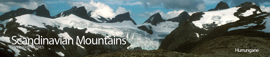
Scandinavian Mountains over 2000 metres - James Baxter
Areas › Hurrungane › 1.10 Midtmaradalstind (2056m)
Store Midtmaradalstind, 2056m, is a seldom climbed, but magnificent craggy peak in the remoter south eastern half of Hurrungane. It has possibly the best view in the whole of the Hurrungane area and offers some superb scrambling. It also offers the longest climbing route in Hurrungane on the huge east face, called Jubileumsveggen, which is nearly a km high. It is flanked on each side by Stølsmaradalen valley and Midtmaradalen valley; 2 of Norway's finest U shaped glacial valleys.
| The Route from Stølsmaradalen Cabin | |
|---|---|
      |
|
From the charming Stølsmaradalen cabin follow the route Hu.16 north to Skogadalsbøen lodge for ½ hour or a km, until you are half way to Snørestødet, 1220m. At this point head north up the steep hillside and veer north west as you climb up 150m.
 Eventually the steepness eases and you can head for the outflow of Storebekkvatnet at the lakes south end. Do not be tempted to head up the hill too quickly from Stølsmaradalen cabin as the steep densely vegetated hill is difficult to negotiate.
From Storebekkvatnet lake head northwest for 1 km to ascend the 300m to Stølsnosi, 1542 m, where you get an exceptional panorama view over the Hurrungane massif. From Stølsnosi continue northwest for a further 3 km over easy undulating to knoll 1749m at the far end of the glacier on the north side.
During the pleasant walk the view gets better still; Storen dominates the north and to the west Austanbotntind rises sharply above everything. The duo of Mannen and Kjerringi look particularly impressive from here.
Søre Midtmaradalstind
From knoll 1749 the terrain becomes more challenging starting with a steep scramble up Søre Midtmaradalstind 1958m, which is straight forward enough and gives a taste of things to come. It is an easy short descent to west from here down to the top of a glacier which is safe and simple to cross for 300m to the saddle between the Søre and Vesle Midtmaradalstind, 2017m.
 Here you get a good view of the massive almost vertical 750m walls on the north east side of the Midtmaradals ridge down to the tranquil U shaped hanging valley of Midtmaradalen. These huge walls are the biggest in Jotunheimen.
Vesle Midtmaradalstind
From this saddle there is a steep climb up to the Vesle Midtmaradalstind. The route starts by skirting round the west side of a steep crag right at the bottom of the ridge. Once this crag has been passed the route veers east again to the apex of the main ridge and goes up steeply between this apex and a small gully parallel to it and 20m to the west. There are 3 bits which are quite steep but are manageable. The gradient of the ridge eases considerably as it reaches Vesle Midtmaradalstind, 2017m.
From the top of Vesle Midtmaradalstind the descent north west down the ridge is exposed and a grade II section needs to be down climbed and then a steep grade II section climbed on the other side of the saddle.
 This exposed scramble can be avoided by descending to the west of Vesle Midtmaradalstind for 20m to gain an easier route on a shelf heading north some 10 m below the saddle on the south west side of this saddle.
From here, below the saddle, there is an obvious ledge running along the south west face of the summit peak. Follow this ledge for 40m until you reach a steep gully running up to the main ridge.
The ledge continues but leave it here and climb the gully for 25m to reach the main ridge. The lower section of this gully is very steep for 5 metres. Once on the main ridge follow it for 5 minutes to the top negotiating one final scramble just before the main summit. The view from here is absolutely stunning and beyond description. There is a small metal box on the summit containing an note book from the first winter ascent in the 1958 for climbers to comment.
The Return
 The return is by the same route. The main ridge is followed down and 30m before the saddle is a stone cairn that marks the top of the steep gully on the south west to reach the ledge 25m below thereby avoiding the difficult and exposed saddle. Once back on the top 1749m it is possible to follow the western edge of the glacier for ½ km. Once this ½ km is completed it is possible to cross the glacier safely in an easterly direction for 300m to the eastern edge.
The eastern side of the glacier is now followed until you reach the glacial streams outflow emerging from under the glacier. Care must be taken to avoid the snow bridge caused by the streams outflow and the steeper section of glacier to the south and west of it must also be avoided as there are small crevasses here.
This glacial stream can now be followed down to Storebekkvatnet lake which is best crossed on the west side. It is again best to aim just south of Snørestødet to join the Skogadalsbøen lodge to Stølsmaradalen cabin path, Hu.16. This will ensure avoiding the steep vegetated slopes on the south side of the ridge.
