Scandinavian Mountains over 2000 metres - James Baxter
Areas › Breheimen
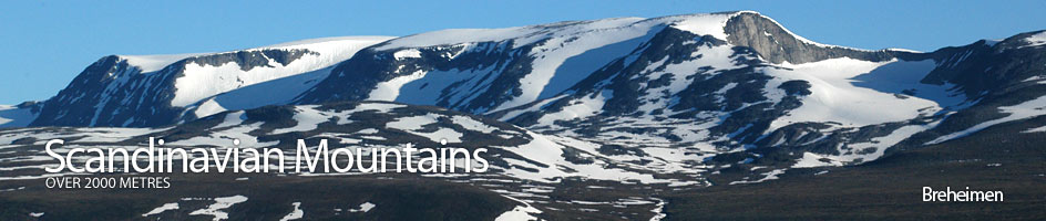
 Breheimen is a large region with a few mountainous areas within it. One theme which characterizes the whole region are extensive glaciers and icecaps. It is bordered to the north by the Riksveg 15 road between Lom and Stryn which runs up Ottadalen to the watershed before descending steeply to the Nordfjord fjord complex.
It is bordered to the south by the Riksveg 55 road between Lom and Sogndal which runs up Bøverdalen to the watershed on Sognefjellsveien before descending steeply to the Sognefjord fjord complex. It is bordered to the west by the deep valleys on the west side of the huge Jostedalsbreen ice cap, the largest glacier by far on mainland Europe.
Mountains & Associated Peaks in Breheimen
| Ref | Name | Height |
|---|---|---|
| 15.1 | Store Hestbrepigg | 2172m |
| 15.2 | Midtre Hestbrepigg |
2160m |
| 15.15 | Vest Midtre Hestbrepigg | 2143m |
| 15.16 | Østre Hestbrepigg | 2132m |
| 15.19 | Låven | 2012m |
| 15.3 | Vestre Hestbrepigg |
2139m |
| 15.4 | Hestedalshøgdi |
2091m |
| 15.5 | Tverrådalskyrkja | 2088m |
| 15.17 | Søre Tverrådalskyrkja | 2034m |
| 15.18 | Sorvest for Fortunsdalsbreen | 2018m |
| 15.6 | Lodalskapå | 2083m |
| 15.7 | Vestraste Hestbrepigg | 2078m |
| 15.8 | Lomseggi | 2068m |
| 15.9 | Midtre Holåtind | 2047m |
| 15.10 | Moldurhøi | 2044m |
| 15.11 | Austre Holåtind | 2043m |
| 15.12 | Vestre Holåtind | 2039m |
| 15.13 | Hesthøi | 2021m |
| 15.14 | Brenibba | 2018m |
Detailed information about Breheimen ›
Walking routes in Breheimen ›
Accommodation in Breheimen ›
Access to Breheimen ›
Breheimen image gallery ›