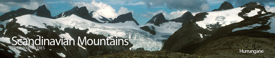
Scandinavian Mountains over 2000 metres - James Baxter
Areas › Hurrungane › 1.6 Dyrhaugstind (2147m)
Dyrhaugstind 2147m, is a long ridge with a few peaks along its length, lying on the north side of Hurrungane. This ridge lies between the valleys of Skardstølsdalen and Midtmaradalen on the east side and Ringsdalen on the west side. This ridge extends south past the deep Berges skar saddle and on to the peak of Nordre Midtmaradalstind before it descends down to two deep saddles and peters out. The summit is one of the easier mountains in the Hurrungane area, however, it is still not possible to amble up to the top as the last ⅓ km requires scrambling with some degree of exposure. The is an annual telemark race the 'Tinderittet' down the broad north ridge of Dyrhaugstind to Turtagrø hotel every May.
| The Route from Turtagrø Hotel | |
|---|---|
      |
|
From Turtagrø Hotel take the path, Hu.8, for 2 km towards the Skagastølsbu shelter and the 'bandet'. After a rise, and about 100m below a small dam, the path to Dyrhaugstind crosses over to the west bank of the stream. The path now goes west under steep ground to a small tarn at 1176 metres by Nedre Dyrhaug knoll, 1207m. After this point the path becomes barely discernable and it is best to follow a south-east direction up through easy soft ground to ascend the ridge. Once on the ridge follow it up to 2 small tarns beyond the Øvre Dyrhaug knoll, 1435m.
 Alternatively is it even easier with transport to drive the 3 km up to the entrance of Ringsdalen valley and park somewhere up the small side road.
From the parking place cross the small dam and then head up through the willow scrub for a few hundred metres until you reach the small saddle between the knoll of Nedre Dyrhaug and the main mountain. Don't go as far as the tarn 1176m but just head up the ridge to Øvre Dyrhaug and the 2 small tarns beyond.
From here the path all but disappears although stone cairns can be seen from time to time. Initially the going is tedious over large scree, but further up the ridge the stones get smaller and the going gets easier.
At this stage there is a large snowfield on the east of the ridge which if firm might be easier to ascend. This snowfield stops short of the top and the stony apex of the narrowing ridge can be followed to the first top Nordre Dyrhaugstind. Here at this top a magnificent view suddenly unfolds over Hurrungane and the arête to the summit can be seen for the first time.
From Nordre Dyrhaugstind, which is marked by a stone cairn, the ridge narrows considerably for the last 300m to the main summit. There is a fair degree of exposure on this section, and in the spring when covered in snow a rope and some slings will add confidence for those who are not used to it. Heading south the ridge initially drops slightly and narrows for 100m until there is a very narrow section which leads to a 3m step. This step is best passed on the west side, where a rock spike offers a good hold and leads to a easy 10m, 45 degree, shelf with further good holds, up to a small peak, sometimes called Rygtind.
 From Rygtind, the ridge drops marginally and then levels out for 100m before rising up a 5m slab to another narrow section. This section is best passed by scrambling up the slab and crossing over to the west before ascending a 15m, 45 degree, shelf with good holds which leads to the summit and its huge cairn.
The continuation south along the ridge for a km, over the other tops to Søre Dyrhaugstind offers more of the same exciting but quite manageable scrambling for those with some experience if the weather is dry and stable. It takes about an hour to traverse the ridge from Store to Søre Dyrhaugstind.
The Return
Unless you are both experienced and equipped you will have to return via the ridge to Nordre Dyrhaugstind and then down the north ridge again. On the descent it is best to make use of the large snow field on the east side of this north ridge. Do not go to far to the east as there is a huge drop down to Skardstølsdalen. At the bottom of this snowfield bear west to avoid the large cliff and then to the 2 small tarns at Øvre Dyrhaug knoll. From here follow the same route as used for the ascent.