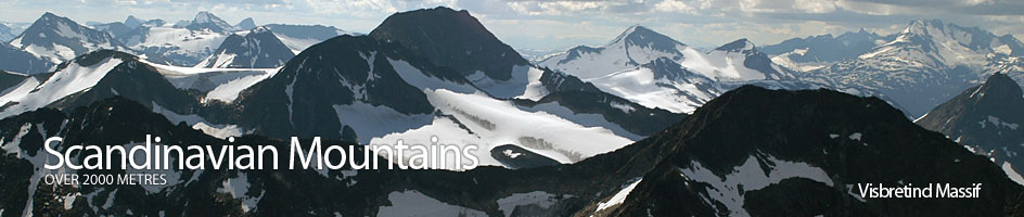
Scandinavian Mountains over 2000 metres - James Baxter
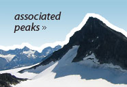
Areas › Visbretind Massif › 5.1 Visbretind (2234m)
Visbretind, 2234m, one of the giants of Jotunheimen, is a spectacular mountain separated from its slightly lower twin of Semelholstind by the tumbling Visbreen glacier. Its splendid northern face is enveloped in a glacier filled corrie. The south flank is a steep boulder field and offers the easiest route to the summit. It is located pretty much in the centre of Jotunheimen.
| The Route from Leirvassbu Lodge | |
|---|---|
      |
|
From Leirvassbu lodge take the well marked path, Ra.2, towards Gjendebu lodge along the west side of Leirvatnet lake and then up a small ridge to the Høgvaglen saddle. At this saddle leave the well marked path and head up a gentle and interesting ridge heading due east for about 2 km to a spot marked as 1843m.
 This point is the top of the western hill of the undulating Kyrkjeoksle ridge. To the north of this point there is a small easy descent down to another saddle from which Kyrkja can be climbed via the south ridge.
From the west end of Kyrkjeoksle follow the very pleasant ridge south east for a further 1½ km which should take you across a long shallow saddle. At the far end of this saddle the ridge gets quite steep as it climbs up to a sharp knoll at 1929m which is the east end of the Kyrkjeoksle ridge.
The is no need to climb this knoll to reach the other side as one can simply traverse round the south side following an contour of about 1870m. This will lead you to the saddle on the east of knoll 1929m which is nearly always covered in a icy snowfield, even late in the summer.
 From the snowfield in the saddle the route now must ascend a steep 100 metre slope covered in loose unstable scree. At the top of this unpleasant section is a rewarding flatter area. To the north of this flatter area are some iron-rich reddish outcrops which sit on top of a very steep slope.
Head towards these red outcrops passing them on the east side then head north east for ½ km across some very rough textured bare rock to reach the saddle between Langvasshøi and Visbretind itself.
From this saddle the final 250 metres goes up a steep scree slope to the summit. If you keep heading in a north east direction the scree slope is not as steep and the rocks are more stable. Indeed it is much easier than it looks.
 At the top of this slope is the short summit ridge. If you have kept to the east of the slope then on reaching the summit ridge follow it west along the arête to the summit.
The Descent
The descent is by the same route. From the saddle between Langvasshøi and Visbretind head over to the reddish rocks. Here just on the east side of them you will find a shallow and gentle gully.
Follow this gully up and it will lead you to the flatter party at the top of the unpleasant steep unstable scree slope that leads to down to the saddle with the snowfield between Langvasshøi and Kyrkjeoksle.
From this snowfield saddle contour round the south side of the top 1929m and make for knoll 1843 metres again. It is possible to start the ascent up Kyrkja from this knoll via its south ridge. If you do this add two hours fro the days tour.