Scandinavian Mountains over 2000 metres - James Baxter
Areas › Memuru Veo Massif › 11.3 Store Heillstugutind (2345m)
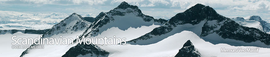
Store Heillstugutinden, 2345 metres, the highest point on a long ridge which contains some six tops over 2000metres on the main north-south orientated ridge itself and a further two 2000m tops on adjacent nunataks which rise out of the Heillstugu Glacier.
| The Route from Spiterstulen Lodge | |
|---|---|
      |
|
From Spiterstulen head south up the wide arterial Visdalen valley keeping about 200m to the east of the river. The path crosses some small streams after 2 to 3 km, then arrives at the glacial torrent of the Heillstuguåi stream which is now bridged in two places. Cross these bridges and continue along the east side of the Visa River for another 2 ½ km until the path forks. Take the south fork which gently climbs out of the main valley towards the mouth of the Urdadalen valley passing to the east of a small gorge. After a further 2 km you will now be in Urdadalen valley itself and the gentle gradient become even more gentle as it continues south across mixed flat areas of softer ground and boulder fields. The boulder fields become more prominent as you head south to the first lake. From here camping possibilities become very limited and uncomfortable for the next 5 km so if you intend to camp it is best to seek a site before the most northerly lake. Continue south up Urdadalen valley passing 2 lakes on the east side. At the end of the second lake, marked 1540m, head south east up a grassy/mossy slopes amid boulders to ascend 150m until you are at the same height but 1/3km north of the small lake near 1693m.
At this point any vestige of softer ground ends and boulders take over. The route continues up the main gully towards the saddle. There is usually a large snowfield in the gully and it is best to stay on the north of this. Indeed it is probably best to go on the northern edge of this gully to avoid any possible stone fall in the gully (especially if there is a party ahead) and ascend on the edge of the stable lichen covered rocks. This ascent is sustained, quite steep and tedious for 300 vertical metres until the gully starts to broaden out into a funnel.
At the start of the funnel continue to keep to the north edge until the funnel eventually eases off and arrive at the saddle. The darker rock beyond the north of the funnel has very heavy lichen growths on it and in the wet must be avoided although in the dry it can offer an alternative route from the start of the funnel onto the main ridge. This alternative could be better in the early summer if the northern lip of the funnel is still under snow.
Once on the main ridge follow the arête north. After the slog of the boulder filled gully and funnel the ascent up the ridge is a delight. It is largely straight forward but has an interesting 5m slab near the top. This slab can be ascended on either its left side or its right side. Care is necessary on the slab as a slip could be disastrous. From the top of this slab it is a short distance to the summit. From the summit the ridge continues north but very quickly arrives at the vertical arête that demands climbing techniques. There is also a stunning view to the north and east across the glaciers to the Memuru-Veo Massifs and beyond, while to the west there is glaciated massif after glaciated massif until Hurrungane. Indeed I would say the grandeur of the view here even exceeds that of Surtningssui.
The descent is by the same route but the snowfield in the gully can be used to descend down. It is relatively steep, 40-45 degrees, and care should be taken if it is at all icy. Otherwise follow the north edge of this gully again over the loose and stable (black and lichen covered) down to the small lake near 1693m.
An alternative that will add 2 ½ hours onto the day but greatly increase the overall enjoyment is to return to the saddle, then instead of descending down the ascent funnel and gully to the small lake, continue south over 2 further tops. There is some very interesting scrambling down from the first top, 2255m, to the next saddle. From this saddle there is an easy ascent up to the most southerly top on the Heillstugu Ridge at 2178m. There is now a simple descent down to the saddle between Heillstugu and Semeltind. From this saddle descend the snowfield/glacier to the lake 1618m and then head up either side of it to gain the short slope which leads up to the Urdadalsbandet Pass and the path to Spiterstulen.
