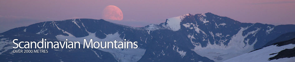
Scandinavian Mountains over 2000 metres - James Baxter
Introduction › Maps
NORWAY
M711 Series
There is a series of 1:50,000 topographic maps which cover Norway in its entirety. This is the M711 series and is produced by Statens Kartverk, the national body. The country is divided up into squares, each of which is numbered. Each of these squares is then divided into four quadrants called I, II, III or IV respectively and is given a title name, and each one is a single map. There are 727 all together.
For each of the areas where there are 2000 metre mountains a few of the maps will be needed. Breheimen alone needs about 8 maps and Jotunheimen 6, Dovre 4 while only Rondane is on a single map. The maps are quite expensive (about £10) and it is not perhaps the cheapest way to go. I have summarized the maps needed for each area:
Area |
Square | Quadrant | Name | Overlaps with other areas |
|---|---|---|---|---|
| Hurrungane | 1517 | IV | Hurrungane | * |
| 1518 | III | Sygnefjell | ** | |
| Jotunheimen | 1618 | IV | Lom | |
| 1518 | III | Sygnefjell | ** | |
| 1518 | II | Galdhøpiggen | *** | |
| 1618 | III | Glittertind | ||
| 1517 | IV | Hurrungane | * | |
| 1517 | I | Tyin | ||
| 1617 | IV | Gjende | ||
| Breheimen | 1418 | IV | Lodalskåpa | |
| 1418 | III | Jostedalen | ||
| 1418 | I | Skridulaupen | ||
| 1418 | II | Mørkrisdalen | ||
| 1518 | IV | Pollfoss | ||
| 1518 | III; | Sygnefjell | ** | |
| 1518 | I | Skjåk | ||
| 1518 | II | Galdhøpiggen | *** | |
| Reinheimen | 1319 | II | Tordsvatnet | |
| 1419 | III | Lesjaskog | ||
| Rondane | 1718 | I | Rondane | |
| 1818 | IV | Atnsjøen | ||
| 1519 | II | Folldal | ||
| Dovrefjell | 1519 | IV | Snøhetta | |
| 1419 | I | Storskrymten |
Turkart Series
This is a series of particular areas which are popular for walking and hiking. Some of them are 1:50000 while others are 1:100000. This is based on the convienience of having all on a single map. It is probably a better bet to opt for these maps rather than the M711 series it will be cheaper and the maps are generally more convienient without mountains being in the corner of up to 4 maps. The quality of the maps, especially the 1.100000 ones are not as good though. Again the price is about £10 per map. Currently there is no map for the Reinheimen area but it is expected soon.
Area |
Map Name | Scale | ISBN Number |
|---|---|---|---|
| Hurrungane and Jotunheimen | Jotunheimen Vest | 1:50000 | 7046660025055 |
| Jotunheimen Aust | 1:50000 | 7046660025031 | |
| Breheimen | Breheimen | 1:100000 | 7046660024119 |
| Rondane | Rondane Nor | 1:50000 | 7046660025239 |
| Dovrefjell | Dovrefjell | 1:100000 | 7046660024973 |
In addition to this there is a a large scale map of Hurrungane with all 14 of the 2000 metre mountains on it. This map is available from Turtagrø hotel and very few other places. It is about £20.
Area |
Map Name | Scale | ISBN Number |
|---|---|---|---|
| Hurrungane | - | 1:25000 | - |
SWEDEN
In Sweden there is a series of 1:50000 topographic maps that covers all but the mountainous area of Norrland. However Norland is the area we need so while this area is being mapped we have to suffice with the 1:100000 Fjällkartan series. This series of 23 Maps covers the entire Swedish Mountains. Each map is about £10. The maps required for the 2000 metre mountains are:
Area |
Map Name | Scale | ISBN Number |
|---|---|---|---|
| Sarek | BD10 Sareks Nationalpark | 1:100000 | 9789158894169 |
| Kebnekaise | BD 6 Abisko-kebnekaise-Narvik | 1:100000 | 9789158894884 |
In addition to this there is a a large scale map of Kebnekaise area with the all three 2000 metre mountains on it in that massif. This map is hard to come by but is very useful. The details are:
Area |
Map Name | Scale | ISBN Number |
|---|---|---|---|
| Kebnekaise | Högfjällskartan Kebnekaise | 1:20000 | 9789158842649 |
Map data in Scandinavia
All these maps in Norway are based on the Geodetic Datum: EUREF 89 . All these maps in Sweden are based on the Geodetic Datum: SWEREF 99. Both of these datums are synonymous with WGS84 (World Geodetic System 1984) and both use UTM (Universal Transverse Mercator) coordinates.
Availability
Most odf the maps are available locally. They can also be pre ordered from Stanfords in London. Tel +44 (0)20 7836 1321 or www.stanfords.co.uk or from other places on the internet.