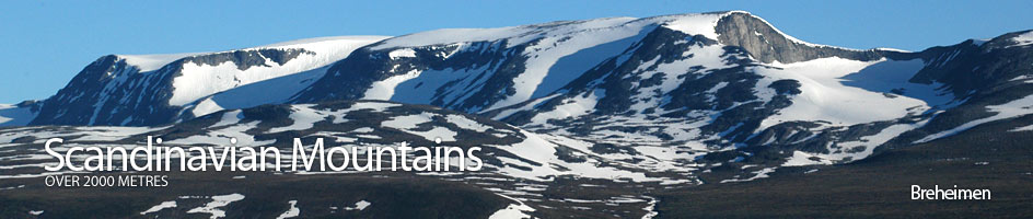
Scandinavian Mountains over 2000 metres - James Baxter
Areas › Breheimen › Austre Holåtind › Alternative Routes
Austre Holåtind is most easily ascended, without crossing any glaciers, from Trulsbu cabin and this is the route I have described below in detail. This can easily be done in conjunction with an ascent of Midtre Holåtind, again without crossing any glaciers and this is also detailed in the route description. This time to do both Austre and Midtre Holåtind is about 6 hours return from Trulsbu cabin as it involves 950m ascent and descent over 11 km
Probably the most satisfying and varied ascent of Austre Holåtind is as part of a grand traverse of all three Holåtinds either as a day trip from Trulsbu cabin or as a journey from Sota Seter to Trulsbu cabin over all three mountains. However this grand traverse involves crossing a large glacier. I have described this traverse in the separate frame below:
The traverse of the three Holåtinds including a glacier crossing.
There are three possible start/finish combinations for a complete traverse of the three Holåtinds. These are:
The traverse starting at Trulsbu cabin and ending at Sota Seter. During this traverse of 20 km there is 1380m of ascent and 1930m of descent. The traverse takes about 11-12 hours.
The traverse can also be done in reverse From Sota Seter to Trulsbu cabin in which case the ascent and descent figures are reversed and two hours should be added. This route is not really recommended unless the days are long (June/July) and the party is very fit.
Finally the traverse can be commenced and finished at Trulsbu cabin which involves 1200m of ascent and descent over 16 km and takes 8-9 hours.
The route I describe is the latter as it is the easiest. However if a party was returning from Trulsbu to Sota seter the same route would be followed until the descent down the south ridge of Vestre Holåtind then the paths would divide.
From Trulsbu cabin head west up Vesledalen keeping to the north side of the river for about two km. This takes you about one km north of lake 1431m. From here you can either head north east up onto the south west ridge of Austre Holåtind which can be followed to the top or you can head north west to the saddle between Austre Holåtind and Midtre Holåtind and follow the west ridge up to the summit of Austre Holåtind. Either route is quite easy. Whichever route is taken the descent from the summit should be down the west ridge to the flat saddle with the huge Gjelåbreen glacier on the north side. From the saddle there is quite a steep ascent up the east ridge of Midtre Holåtind. Earlier in the summer season this could have a steep snowfield across the ridge and as always an ice axe should be carried. From the summit of Midtre Holåtind the route now heads south west for 200 metres until the slope to the west eases enough to allow a descent down to the glacier. The glacier should be crossed on a west bearing for about ½ km to the base of the east ridge of Vestre Holåtind. Crevasses are usually minimal across this neck of ice but a rope is still essential. On the west side of this glacier the gradient becomes steeper as it climbs to the east ridge. This ridge is largely composed of recently exposed bare rock and is initially not too steep. Towards the top the ridge becomes much steeper and offers some good scrambling. This steeper section can be avoided by traversing across scree covered ledges to the south west until the main south ridge is gained which can then be followed to the summit. Again early in the summer season much of this east ridge is usually covered in steepish snow banks and an ice axe is essential. The descent of Vestre Holåtind is down the south ridge.
If the return is being made to Trulsbu cabin descend down to the Holåbreen glacier and cross it to the north east of lake 1551m heading south east towards a point to the west of knoll 1816m. Be very cautious of some surface streams which have carved deep slots into the ice while crossing this section of glacier. From here continue south east for a km to the tarn at 1589m where the marked path to Trulsbu should be intercepted and followed for about one and a half hours. If the return is being made to Sota seter descend down the south ridge for about a half km, then head west down the steepish slope to the Stillgrovi stream. Cross this stream and continue west, then north west contouring round the southern slopes of Hill 1857m and knoll 1629m for about three km until the stream coming down from Tundradalsbandet pass is met ideally at about 1420 metre elevation. Here the marked path to Sota seter should be intercepted and followed for a further three hours.