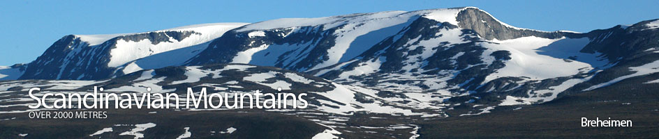
Scandinavian Mountains over 2000 metres - James Baxter
Areas › Breheimen › Tverrådalskyrkja › Alternative Routes
There are a number of alternatives to ascending Tverrådalskyrkja. The easiest is the is the ascent from Sota sæter via Steindalen, Styggvatnet and then, after a small section of Fortundalsbreen glacier, up the east ridge. This is the route I have described below in detail. There are other possibilities for an ascent but all these are much more demanding than the standard route I have described in detail. These alternatives are:
 The north ridge which is a climbing of grade IV. From the lower end of Steindalen head up the steep slopes of the north buttress for 600 vertical metres. Much of the lower slopes are covered in a large steep snowfield during the early summer. The remainder of the ascent is across stable boulders until the top of this buttress is reaches at about 1990m elevation. From here the ridge narrows into an exposed arête with considerable drops on each side. After about a horizontal km the arête becomes much steeper and eventually vertical and very exposed for 2 pitches of grade IV before the summit.
It is also possible to ascend Tverrådalskyrkja from the west via Kollebreen glacier. From Sota sæter head up Tverrådalen and pass on the south side of the small tarns 1265m and 1268m. Continue up the stream to reach the lake at the snout of the glacier. Pass round the north side of this lake and onto the eastern edge of the Kollebreen glacier. Follow this eastern edge for two km until the glacier gets much steeper to the north of as rocky ridge.
Cross the rocky ridge and then head east for a km to gain the saddle the subsidiary peaks of Søre Tverrådalskyrkja, 2034m, and SV for Fortundalsbreen, 2018m. From this saddle follow the narrow arête north east for a km to reach the main summit. There are crevasses in Kollebreen so this route is only suitable for parties experienced in glacier travel. In the spring this route does not have the glacier complications but the sharp arête from the saddle to the summit is covered in snow. There is a steep alternative summer route from the glacial lake at the snout of the Kollebreen glacier which avoids any glacial travel but this involves scrambling from the glacial lake up one of the steep spurs which become much steeper towards the top and involve some climbing before arriving at the south arête.
Tverrådalskyrkja can also be ascended via the south in the spring after a long ski over Harbardsbreen glacier from Nørdstedalseter. This involves extensive travel over the glacier and should only be attempted by experienced parties. The route from Nørdstedalseter goes east for five km up Gravdalen to the lake at the end of the glacier at 1473m. From here go on to the glacier and ski for three km to the north west to the highest point. From here ski six km to the peak SV for Fortundalsbreen, 2018m. From this peak follow the arête north for two km to the main summit.
These ascent routes can also be used as descent route should the conditions permit and the experience of the party make plausible.
It should be noted that the glacier to the north and west of the peak SV for Fortundalsbreen, 2018m, is heavily crevassed and should be avoided in the spring and summer. Also, if returning to Sota sæter from Nørdstedalseter across Fortundalsbreen glacier extreme care should be taken to avoid the wind sculptured ice cliffs to the south and west of Sveinkollen, 1743m. These cliffs can be 30 metres high and in bad weather will not be visible, making it very easy to ski over them!