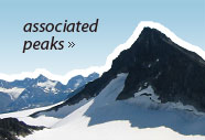
Scandinavian Mountains over 2000 metres - James Baxter
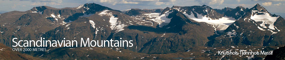
Areas › Knutshols Tjønnhols Massif › Knutsholstind › Alternative Routes
There are several ways up Knutsholstind. Most of them are quite demanding. The simplest way up is via the west face where a indistinct steep spur can be followed all the way to the top in a punishing 900 metre slog. This being the simplest route is described below in detail.
 Another route which is far more interesting, is up the south arête, but this involves some difficult scrambling/easy climbing of grade III for 50 metres towards the end. I shall describe this now because if the party is experienced it is well worth considering. This route was also the route of the first ascent in July 1875.
From the north end of the highest lake in Svartdalen (1490m on the map), which can be accessed equally from either Torfinnsbu or from Gjendebu lodges, head straight up towards the summit of Knutsholstind, i.e. north east, for about 500 metres across a sloping terrain of a grass/boulder mix. After 500 metres you should be at the bottom of an obvious wide scree covered rake which ascends some 500 vertical metres over 1 km in a easterly direction. This remarkable rake leads all the way to the saddle between Knutsholstind and Søre Knutsholstind.
 From the saddle head north up the south ridge which initially is wide and easy for 500m until a bulge. From this bulge the ridge now becomes an arête for another 300m and is simple to follow. This arête leads to the bottom of a steeper section about 100 metres below the summit. This steeper section can be tackled up the apex of the arête for a steep 80m of exposed grade III climbing, but on firm rock. At the top of the climb is an easy arête which is easily followed for 100m to the summit. The exposure is significant and a rope and protection could be useful.
Much of this climb can be avoided on the west side by another grade III climb of less exposure. For this less exposed alternative traverse from the bottom of the steep section westwards for 40 metres across and easy ledge until you reach a corner. Climb 8 metres up this corner with excellent holds to gain a spur. Follow this spur up for 20 metres to the bottom of slabs. There is now a exposed 20 metre climb up firm slabs with acceptable holds to the main south ridge again.
The climb up these slabs is probably easiest slightly to the right (south) where it is a grade III. Once on the main south ridge again there is a final 20 metres up a grade III nose, with good holds (this is also the top of the 80m climb). This leads to the final 100 metres of easy arête to the summit. Again for this a rope and protection could be useful, depending on experience, unless the weather is less than good and the rock is wet when it is essential.