Scandinavian Mountains over 2000 metres - James Baxter
Areas › Rondane › Walking Routes › Ro.1
| Ro.1 | Spranget parking to Rondvassbu lodge |
|---|---|
| 1 ½ hrs / 7km 130m |
Gravel road which is locked to the public for vehicle access but is open to cyclists. Marked in the spring with twig poles. |
From Mysuseter the road continues past a toll boom and climbs for one km up the hillside, passing the tree line and onto a flat plateau. It continues across the plateau for another 3 Km heading north west until there is a large parking place at Spranget, so called because the deep gorge through which the River Ula rushed could once be leapt over at this point.
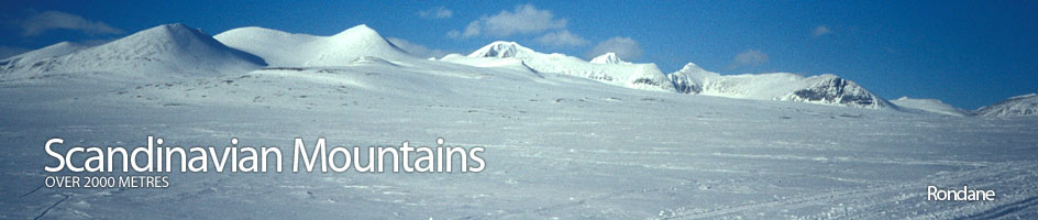
At Spranget the gravel road is blocked by a locked boom and the remaining 7 km must be done on foot or very easily by bicycle. The almost flat journey up the wide valley leads towards the steep mountains in the heart of Rondane.
As one approaches these mountains a deep cleft emerges. This is Rondvassdalen and at the southern end of the valley and lake is Rondvassbu lodge. The gravel road goes straight to the lodge. In the spring the road from Mysuseter is buried by snow but the ski trail, which is marked by cut branches/twigs, follows the road to Spranget.
From here it crosses to the west side of the River Ula and continues along the marked trail, sometimes surprisingly far above the river, to the south end of the lake which it then crosses. Rondvassbu lodge is at the hub of a web of walking paths.