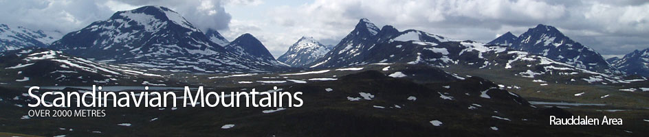
Scandinavian Mountains over 2000 metres - James Baxter
Areas › Rauddalen Area › Walking Routes › Ra.5
| Ra.5 | Fondsbu lodge to Olavsbu cabin via Øvre Mjølkedalen |
|---|---|
| 5 hours / 13km 720m |
Marked path in the summer and in the winter a ski route marked with twigs. |
Leave Fondsbu lodge and follow the path Ur.1 for 3 hours. This path heads north for ½km on the gravel road crossing the Mjølkedøla river on a bridge. Just after the bridge leave the road and start heading up the road on the east of the river up to the cabins.
Follow this for ½ km until the road ends and a marked path starts 100 metres east of the river. The path now climbs up, initially through willow scrub, for a km until it veers north and away from the river and up a side valley climbing up onto a small ridge. Here a marvellous view unfolds straight over Mjølkedalsvatnet lake and up Mjølkedalsbreen glacier into the heart of a wild icy massif.
Continue north round the east shore of this spectacular lake into the obvious valley between the steep mountains of Storegut and Høgbrothøgdi. After going up this valley for a km you pass a small tarn and a marshy area before starting a short ascent up to small saddle between knolls. There is a marked junction here with the path Ur.1 branching off to the west. Don't take this path but continue up the rocky slope and round the west side of a knoll at the foot of the north ridge of Høgbrothøgdi. Here you reach a magnificent viewpoint down Øvre Mjølkedalen and its string of lakes to the north west and into the wild barren heart of Jotunheimen with the rugged mountains of the Rauddalen area to the north.
Just after this you reach a prominent saddle and another junction with the path Ra.4. The east fork goes to Gjendebu lodge and the west fork to Skogadalsbøen lodge. Don't take either but continue north and traverse down the rocky slope to the barren wasteland and round the west shore of Øvre Snøholsvatnet lake. Pass this lake and then ascend a large rocky basin dotted with tarns as you make for the shallow pass between Snøholstind and Mjølkedalstind.
After this pass start the gentle rocky descent for ½ hour to reach lake at 1444m. The path now weaves past through the boulders on the west shore of this lake under the threatening east face of Olavsbunuten. Once past the lake it is a easy km across pleasant tundra to the bridge over the stream and Olavsbu cabin.
The winter ski route, which is marked with twigs, pretty much follows the same route except in the vicinity around Høgbrothøgdi. Instead of going to the west of this massive hill it goes to the east of it and then over the Snøholsvatnet lakes.