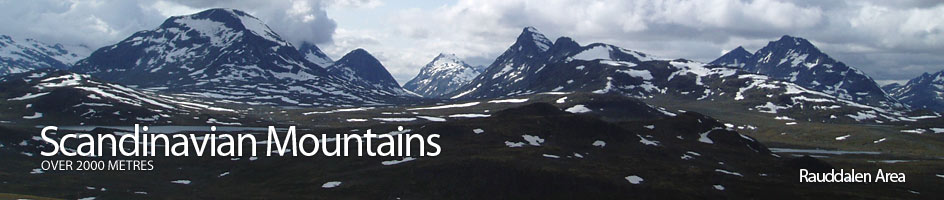
Scandinavian Mountains over 2000 metres - James Baxter
Areas › Rauddalen Area › 4.5 Mjølkedalstind (2138m)
Mjølkedalstind, 2137 metres, is one of the most iconic mountains in Jotunheimen. It's sharp, free standing summit stands proud above the remote surrounding valleys. The mountain lies at the wild heart of Jotunheimen. There are some small glaciers on its northern flanks but these are fast becoming snowfields. Although it looks a difficult peak to climb there is a relatively easy ridge which can be followed to the top.
| The Route from Olavsbu Cabin | |
|---|---|
      |
|
Leave Olavsbu cabin, cross the river over the bridge then head downstream for a few hundred metres on the path Ra.7, which goes to Skogadalsbøen lodge. Leave the path went it veers north and traverse up across damp stony meadows and mossy areas into a open valley before the north ridge.
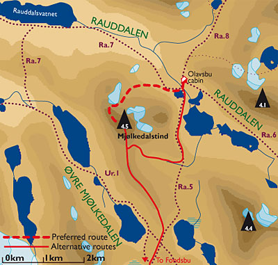 Weave up through snowfields and slabby outcrops for an hour until you reach a large snowfield/glacier on the east side of a saddle on the skyline between knoll 1808m and Mjølkedalstind itself. Head across this snowfield to the saddle.
North West Ridge
From the saddle, the north west ridge proper starts. Head up the ridge to the foot of a much steeper section keeping slightly to the west of the apex where there are cairns marking the best route. If you go too far east there are wet slabs to scramble up later.
This steep section, at about 1900 meters elevation, involves some 50 metres of very easy scrambling up across coarse blocks with good holds. At the top of this enjoyable scramble is a slightly flatter section from where there is a great view up the arête to the summit. There are also great views here southwards to the Uranos massif.
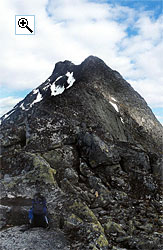 The Arête

The route from this level area to the lofty summit above now follows the arête the whole way. The arête itself is a joy to follow for the final 45 minutes to the summit. It is generally 5 metres wide but occasionally narrows to a couple of metres. Most of the ascent is on solid rock devoid of lichen.
There are a couple of places where it is necessary to clamber up some steeper sections but none of these are exposed, but some are interestingly airy. On each side of the arête are very steep drops down hundreds of meters to the scree strewn lower slopes. Just before the summit the arête narrows to a mere metre.
The Return
The return is by the same route. In the early part of the summer there will be long snowfields to glissade down after the saddle with the knoll 1808m.
Alternatively it is possible to traverse around the very loose north flank of the mountain from the saddle with knoll 1808m to the saddle with Olavsbunuten, 1970m. This latter saddle is also covered with a large snowfield throughout the summer. From here is it easy to descend down initially stony slopes into the corrie to the east.
Once on the tarn covered floor of this corrie either return to Olavsbu cabin allowing 5-6 hours for the return trip or head down to Fondsbu lodge allowing 7-8 hours for the trip from Olavsbu cabin.
